In today’s world, all sectors are striving to optimize production processes aiming to get the maximum benefit with minimum investment. In the agricultural industry, a tool for increasing the efficiency of all stages of production is the introduction of the so-called precision farming. The concept of precision farming implies the use of various technologies, including remote sensing with the help of satellites, to reduce labor and material costs while increasing the quality and quantity of the product.
Satellites are one of the main tools for managing land effectively since satellite images make it possible to assess reliable field data remotely. The main advantage of remote methods is the large coverage and the ability to quickly obtain the necessary information for smart decision-making, including data on crop state based on vegetation indices – CI index (chlorophyll index). In ground sensing, labor costs are much higher and the entire process is longer and more complicated.
Remote Sensing
Remote sensing is a method of obtaining information about an object or phenomenon without direct physical contact with that object. In the modern understanding, the term mainly refers to technologies of airborne or spaceborne sensing of the area for the purpose of detection, classification and analysis of objects on the earth’s surface, as well as the atmosphere and the ocean, by means of distributed signals (e.g. electromagnetic radiation). It is divided into active (the radiation is first emitted by an aircraft or space satellite itself) and passive remote sensing (the radiation by the Sun is used).
Basically, remote sensing satellites “read” electromagnetic ration in the infrared, visible, microwave, and ultraviolet wavelengths radiated or reflected from the Earth’s surface. Taking multiple images of the Earth’s surface in more than one wavelength (multispectral imaging) satellites enable collection of invaluable data that couldn’t be obtained from ordinary photographs.
Since different features like water, soil, vegetation, etc. reflect the light in a different wavelength when sunlight falls on them, it enables classification of generated satellite imagery with each feature highlighted in a different way for further analytics.
Optical Crop Sensors
Modern agriculture uses different optical sensors to measure crop reflectance for plant state tracking. Such sensors are satellites, UAVs, and ground-based devices. The sensors evaluate various crop conditions by using specific wavelengths, from monochromatic to multi-spectral (up to 10 wave bands) and hyperspectral (over 10 wave bands).
By emitting the light of specific wavelengths at crop leaves, sensors measure the type and intensity of the light wavelengths reflected from the leaves back to the sensors. The results of such measurements are usually represented in the form of vegetation indices, including the famous NDVI, Chlorophyll Index, LAI, and many others.
Hyperspectral remote sensing shows great potential and makes it possible to improve in the classification of different types of crops, extract data on biophysical and biochemical contents, evaluate nutrient content, and detect abiotic and biotic stresses. Hyperspectral remote sensing technology makes it possible to map different types of crops in terms of physiological characteristics in different spectral bands.
Chlorophyll Index
Chlorophyll index among the most used and effective indices in modern farming. The reason being is that chlorophyll itself is what gives plants their green color. More importantly, this pigment enables plants to absorb the sunlight which is then converted into sugars and starches via a process of photosynthesis. Therefore, chlorophyll content is a great litmus paper when it comes to analyzing crop health.
Measuring the spectral reflectance of chlorophyll in plants with the help of satellites, growers can easily monitor the state of their crops. For this, the chlorophyll ag index is used. If interpreted correctly, the index can offer valuable insights on crop development, which can be used for detection of nutrient deficiencies in plants, Nitrogen fertilizer application planning, yield prediction, and more.
For example, the Green Chlorophyll Index can be successfully used for a wide range of plants. Green Chlorophyll Index formula is the following: CI green = ρNIR / ρgreen – 1 = ρ730/ρ530 – 1. Basically, it’s the ratio of the chlorophyll’s reflectance in the NIR band over the reflectance in the green band.
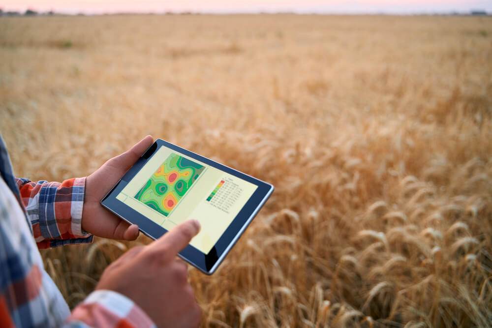
Vegetation indices data can be accessed via different farm management software. One of them is EOSDA Crop Monitoring. The platform offers a variety of features alongside different vegetation indices for a comprehensive field analytics.
As for the chlorophyll index, the tool uses one based on the red-edge band – ReCl. This particular chlorophyll index is a great helper when creating a precise map of a field for variable-rate application of fertilizers. Because chlorophyll content directly depends on nitrogen level in plants, this index enables detection of field areas with yellow or shed foliage.
ReCI is best to use during active vegetation development and not when the plants are reaching the last maturity stage.
Overall, modern possibilities of remote sensing technology go sky high. Farmers can now monitor their fields and crops sitting at home or in the office. Just a couple of clicks and you can find out what your field needs, where, and how much. Such remote and smart management of farmland results not only in processes optimization, abundant yields, and saved time and money, but also in sustainable development of agriculture as an industry.